GSatTrack for your Customers: Map Controls and Features
Building Business To Business (B2B) Relationships
GSE provides products and services to a whole host of people, companies, and organizations. Some of our most beneficial relationships have come from B2B activity. Many of these businesses combine the products and services that GSE provides with their own to enhance their clients' experiences. This model has proven effective time and again for GSE, the business partners we work with, and the clients they serve. Everyone wins as a result.
Series Overview
Since GSE loves finding new opportunities to partner with other businesses, it only makes sense to highlight a blog series focusing on resellers and selling partners. GSE defines resellers as businesses who market our products directly to their customers, or those who combine our products and services with theirs, and then sell that package to their clients. This model allows both companies to build upon each other's strengths for the benefit of the client. The versatility of our GSatTrack platform makes it super easy for companies to integrate our platform into their telematics solution. This series will highlight key features of GSatTrack that can be a major benefit to resellers and their clients.
Consumer Obstacles
There are many great tracking devices available on the market today with a range of capabilities, functionalities, and intended uses. As the capability and functionality of the device increases, then often so does the cost to purchase and operate the device increase as well. The reality is that the Return On Investment (ROI) for more expensive hardware often does not justify the cost to purchase, integrate, and operate newer hardware at higher costs. This dilemma leaves many consumers on a quest to find the cheapest product with just enough capability and functionality with a satisfactory ROI. The question is always, "How do I get more with paying less?"
The Solution
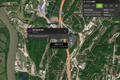
GSatTrack offers an extensive set of data visualizations that can increase or even add to the capability and functionalities of most internet, satellite, and cellular connecting devices. This means a consumer can purchase a device or set of devices with limited capabilities, such as a device that only reports location, and drastically increase data visualization by connecting it to GSatTrack. The consumer can visualize the assets' locations in near real time, or over a period of time as the asset reported. The user can use different maps to visualize the assets' locations in a number of ways, such as with satellite imagery, with roads and labels, or with terrain depth. Users can also add a multitude of layers to the map or even upload custom layers to better visualize how the asset is interacting with the world around it. The GSatTrack Map tools and features are broken down below.
Map
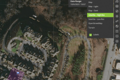
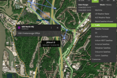
The map in GSatTrack can be viewed in a number of ways:
- The default map shows roads, terrain depth, reserves, and user created features.
- Map - Light and Map - Dark simply shows land, water, and roads in either light or dark mode.
- Satellite - High - Res shows high resolution images while Satellite - Low - Res offers low resolution images of the world. Both can be viewed with and without Labels.
- OpenStreetMap is simply a navigation map that shows all roads and waterways.
- Terrain is very similar to OpenStreetMap but offers terrain depth and geographical features.
Map Mode
The map in GSatTrack can be viewed in Live Mode or History Mode.
- Live Mode shows user items as they currently stand.
- History Mode can be viewed in 1-Hour, 24-Hours, 7-Days, 1-Month, or a custom Date Range chosen by the user.
- History Mode will show locations reported from assets within the time frame that was chosen. This is great when viewing reports which we will cover later in the series.
Map Features
GSatTrack offers a number of features that enhance the usability of the map and platform.
- Legend - the legend shows all Asset Statuses and Icon Symbols used in GSatTrack.
- Layers - offers a number of special layers that can be added to the map and even has the ability to add custom map layers.
- Get Route - will generate turn by turn directions between either two addresses or two selected locations on the map.
- Ruler - will show linear distance between two or more locations on a map.
The Result
Most consumers want to increase their ROI while decreasing the cost of purchasing, integrating, and operating new hardware. GSatTrack offers a way for consumers to increase the capabilities and functionalities of many tracking devices through data visualizations on the portal itself. This means consumers can have a better understanding of how tracking devices are interacting within their data ecosystem and improve their efficiency over time. Resellers can offer GSatTrack as a bundle package with their tracking hardware as a way to extend or increase the feature set that those devices offer. What better way to extend or increase a device's feature set than in depth and advanced data visualization?


