Construction Companies use GSatTrack for BIM
Most GIS systems incorporate mapping imagery or layers is by purchasing licenses from a single mapping provider. This provider may also offer additional historical satellite imagery for use by the GIS provider, but the images provided may be antiquated or out of date, with recent construction or natural events which change the natural landscape and topography of an area omitted. To address this, clients often opt to use their own imagery in conjunction with the GIS systems they employ. This downside to this approach is that by having two systems or locations for mapping imagery, there is an immediate disconnect created making the real time data needed by users of a GIS systems irrelevant.
It is for this very reason that rather than being tied to a single mapping provider, GSatTrack employs several mapping solutions while allowing users to import their own maps directly into the system. This can be done using Keyhole Markup Language (KML) files, Tile Map, GeoJson, GPS exchange format, Image overlay, and Web Map Service. This also isn’t restricted to fixed imagery. GSatTrack can even manage automatic data feeds from outside sources ensuring our clients have the very best and most recent imagery available at all times.
About GSatTrack
GSatTrack is a web-based, integrated satellite and GSM tracking solution, compatible with modern web browsers and works on a multilingual platform that brings together all the positions of every manufactured product under one location and displays and manages them in a single unified interface. With GSatTrack, asset locations and movements - including position, speed, altitude and heading - are tracked in real-time worldwide via GPS updates.
By using GPS satellites with the latest hardware and technology, any asset on earth, whether it's people, vehicles, containers, or any moving object can now be tracked. Our technology allows the integration of all types of tracking equipment into one easy to use platform. The tracking equipment determines its location by triangulating a position using GPS (Global Positioning System) and then transmits this information via GSM, Satellite, or VHF to a central server for processing. Any operator can view and control any number of real time assets simultaneously.
The Customer Situation
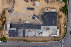
A construction company was making use of drone imagery to deliver Building Information Modelling (BIM), which is the process of creating and managing information on a construction project across its life cycle. The BIM is used to provide cut and fill information to reduce total project cost, volumetric analysis reducing earth moving costs, and progress surveys allowing the company to more accurately measure timelines.
The use of drones in BIM is now the preference of a number of construction firms around the world, as it significantly reduces operational risk to workers, and also improves the accuracy and efficiency of many different types of inspections, surveys, and status checks. The UK has implemented mandatory BIM level 2 requirements across all construction projects, but adoption of BIM standards elsewhere in the world, including the United States, has been slow.
The Challenge
In modern construction, the analysis of information and data is essential to the efficiency of construction sites and the delivery of complete operations. It is rare, however, that all this data is assembled in one place. This can lead to the hiring of several specialists or engineers familiar with a single software solution or having to gather information from several data points without providing synergy across all these platforms. In this way, when these systems do not cross-function and combine project information in a single portal, the opportunity to streamline processes and make projects run more efficiently evaporates.
The Solution
GSatTrack was developed with the understanding that the most powerful telematics solution is one that remains agnostic in its approach to technology. Whether this means incorporating data from any source including satellite, cellular, radio and LoRa, or any piece of hardware capable of operating using these sources, the solution that is most useful is the one that embraces technology rather than limiting it. GSatTrack has the ability to integrate custom maps and imagery through API and direct data feeds, allowing it to gather BIM data from almost any source that connects to a network or gathers digital information.
The data feed from their drone footage was immediately integrated with GSatTrack to make sure the data was visually represented over the GIS system. GSatTrack also allowed the construction company to further control additional items associated with their construction site including the whereabouts of the construction fleet and tools, reducing risks and allowing various heavy equipment to move from one area of the site to another as data was provided from onboard telematics paired with the drone data.
The Result
The construction company, already heavily invested in technology, was able to quickly integrate the GSatTrack solution, allowing them to have greater control of their technology in a central location rather than several sites which require specialized operators to manage. Instead all the data from their construction sites is now presented visually on the powerful telematics platform. This is achieved through direct data and scheduled reports which has contributed more broadly to reduced costs associated with machine management, resource allocation, workflow and overall adherence to schedules. By making use of GSatTrack and allowing the team of engineers and consultants at GSE to provide a solution that addressed their needs, this construction company saved themselves money while ensuring they had a way of being prepared for new technologies as data and other information sources became available.


